01
Live tracking & geofencing
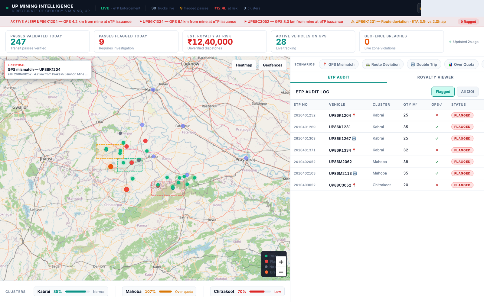
GPS positions of registered vehicles on a live map, with geofences around mines and approved corridors, raising an alert the moment a vehicle exits its zone.
This document sets out the capabilities of a proposed monitoring system for the Directorate of Geology & Mining, Uttar Pradesh, illustrated through a working prototype, together with an assessment of what would be required before deployment.
Sand, stone and minor minerals are transported through the State's mining corridors under the electronic Transit Pass (eTP) framework. Given the volume of dispatches and the distances covered, confirming route adherence and pass utilisation in real time can be difficult from records alone. The capabilities below are intended to add a layer of real-time visibility and analysis on top of the Directorate's existing regulatory framework.
GPS positions of registered vehicles on a live map, with geofences around mines and approved corridors, raising an alert the moment a vehicle exits its zone.
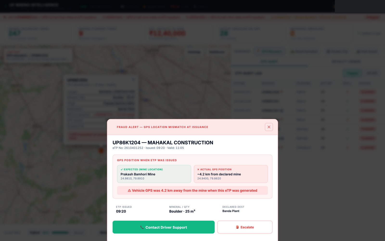
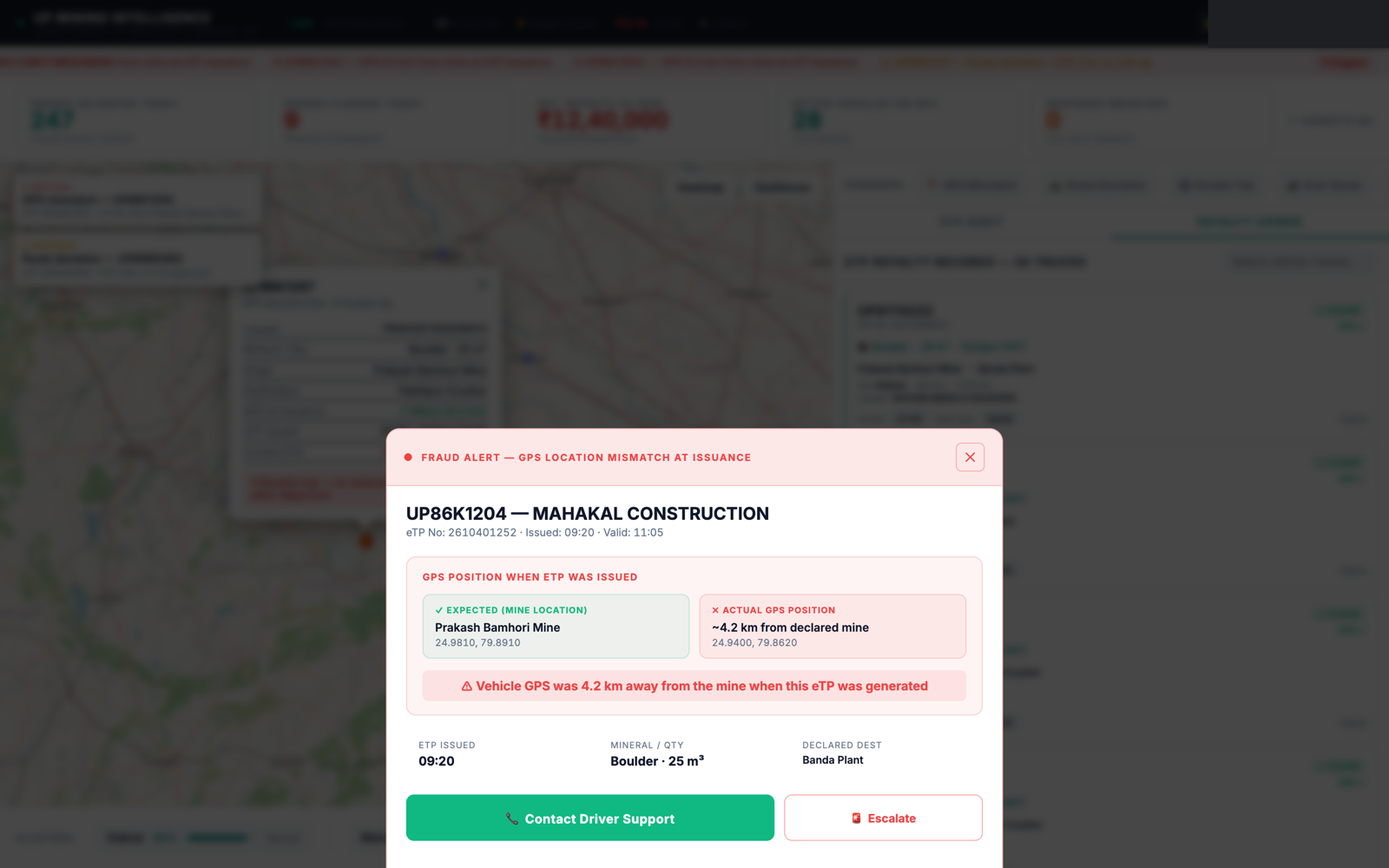
Cross-checks each electronic transit pass against GPS reality at issuance, flagging mismatches between the declared mine location and where the vehicle actually was.
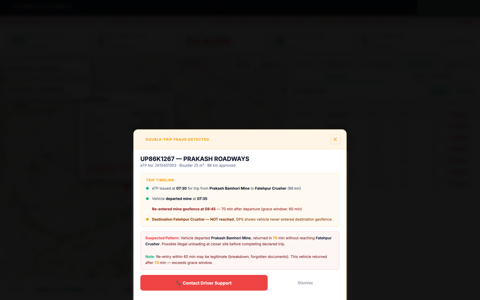
Flags route deviations against the approved path, and vehicles re-entering a mine shortly after a declared dispatch, a pattern worth a closer look for undeclared second loads.
District- and cluster-level view of dispatch volume against permitted volume, surfacing where utilisation is running over quota.
Every flagged pass carries its GPS trip timeline and declared-vs-actual route, ready to hand to an enforcement officer.
One-tap escalation to a Regional Enforcement Officer (roadside check, 15-min response target) or the Driver Support Control Room.
Prepared with reference to the Directorate of Geology & Mining, UP mandate. This is a functional prototype, not a static mockup: the screens described below are interactive and demonstrated in person.
The prototype currently operates on illustrative data. Deployment for departmental use would require integration with the systems listed below.
| Capability | Status | What's needed for production |
|---|---|---|
| Live map, audit table, royalty viewer, case views, alert log | Demo-ready | Re-skin with Directorate branding; connect to an officer login/directory. |
| Flagging & double-trip detection logic | To build | Tuned on historical eTP and GPS data; needs a data-sharing agreement. |
| Live GPS feed (AIS-140 / vehicle telematics) | Needs integration | API access to the GPS/AIS-140 vendor or fleet telematics provider. |
| eTP / e-Way Bill systems | Needs integration | API or DB access to the government transit-pass system of record. |
The dashboard is available for a full walkthrough, including live map, a flagged transit pass, and the resulting escalation to an enforcement officer.